Wabi-Sabi

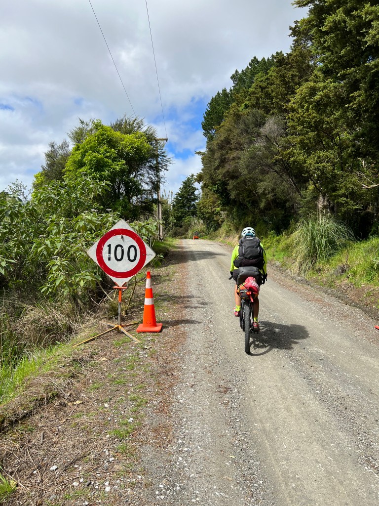
  • Day 23 Miyanoura to Onoma 44kms 1187m
  • Day 24 Onoma to Miyamora 65 km 1939m
  • Day 25 Naze to Koniya. 93 kms 2332m
  • Day 26 Koniya to Sasari 87 kms 1715 m
  • Day 27 Sasari to Naze 85 kms 1312m
  • Day 28 Motobu to Ada 90kms 872m
  • Day 29 Ada to Onna 104 kms 1561 m
  • Day 30. Onna to Naha 56 kms 644 m
  • TOTAL TODATE. 2359kms 36,434m

2500 kms in 31 days of riding; 25 or more different islands (we lost count); several ferry rides but two (very) long ones; 9 rest days; and 36 kms of climbing (the most vertical per km of riding of our other long haul rides in Canada, New Zealand, Tasmania or SE Asia).

Our assessment? A wild success! Loved it.

Our bikes faired well. We needed the low gearing on this one to be certain. Other bikes on the tour needed frequent repairs. The route, though hard topped, was rough at times and often had menacing debris. There were broken rims, broken chains, broken derailers, many flat tires and many, many changes of break pads. For riders, there was one broken shoulder, one broken wrist and one rather impressive road rash incident. Out of 30 riders. Not bad – considering the terrain, length and considerable grade.

The weather was excellent for the most part. Still, at one time or another we used all of the gear we brought with us, even long underwear base layers, rain pants, heavy weather Arc’teryx jackets, rain booties, hoodies, toques and winter mitts. Our local Japanese expert, Kazu, kept telling us how “lucky we’ve been with weather”. Well, that changed. The weather forecast for the Island of Okinawa looked daunting to say the least with a typhoon expecting to come through about the same time we were. But first:

Yakushima Island – more monkeys than people

We circled Yakushima Island over two days and 130 kms. 90% of the island is covered in subtropical rainforest. It rains so much on this island it is said it rains 35 days a month. And yet we continued to avoid the weather with only a few showers. The island has mountains peaking over 1800 m high and despite being subtropical, they can get snow in the winter. A quote from a tourist brochure states: “Yakushima will have clear blue skies and beautiful autumn days ……. but for occasional typhoons”. A foreshadowing to be sure.

Yakusugi Cedars live over 1000 years on this island. Due to the harsh environment, poor soil and high humidity, the cedar trees grow slowly storing resin, which makes them resistant to decay and insects. This prolongs their life spans much longer than ordinary cedars. The Jomonsugi Cedar – “the lord of the forest” has a trunk circumference of 16.4 meters and is estimated to be anywhere from 2000 – 7200 years old! This reminded us of the mighty Kauri Trees of New Zealand.

Oh, and the monkeys! Everywhere! We found ourselves dodging and weaving around them at every turn. We were warned: “Don’t look at them directly and don’t engage them or stop in the middle of them. Keep riding by, “or else.” We did as advised and luckily never found out what “or else” meant. You would too if you saw their cute but decidedly menacing look.

Amami Island and TDA’s Motto – Hardship and Suffering

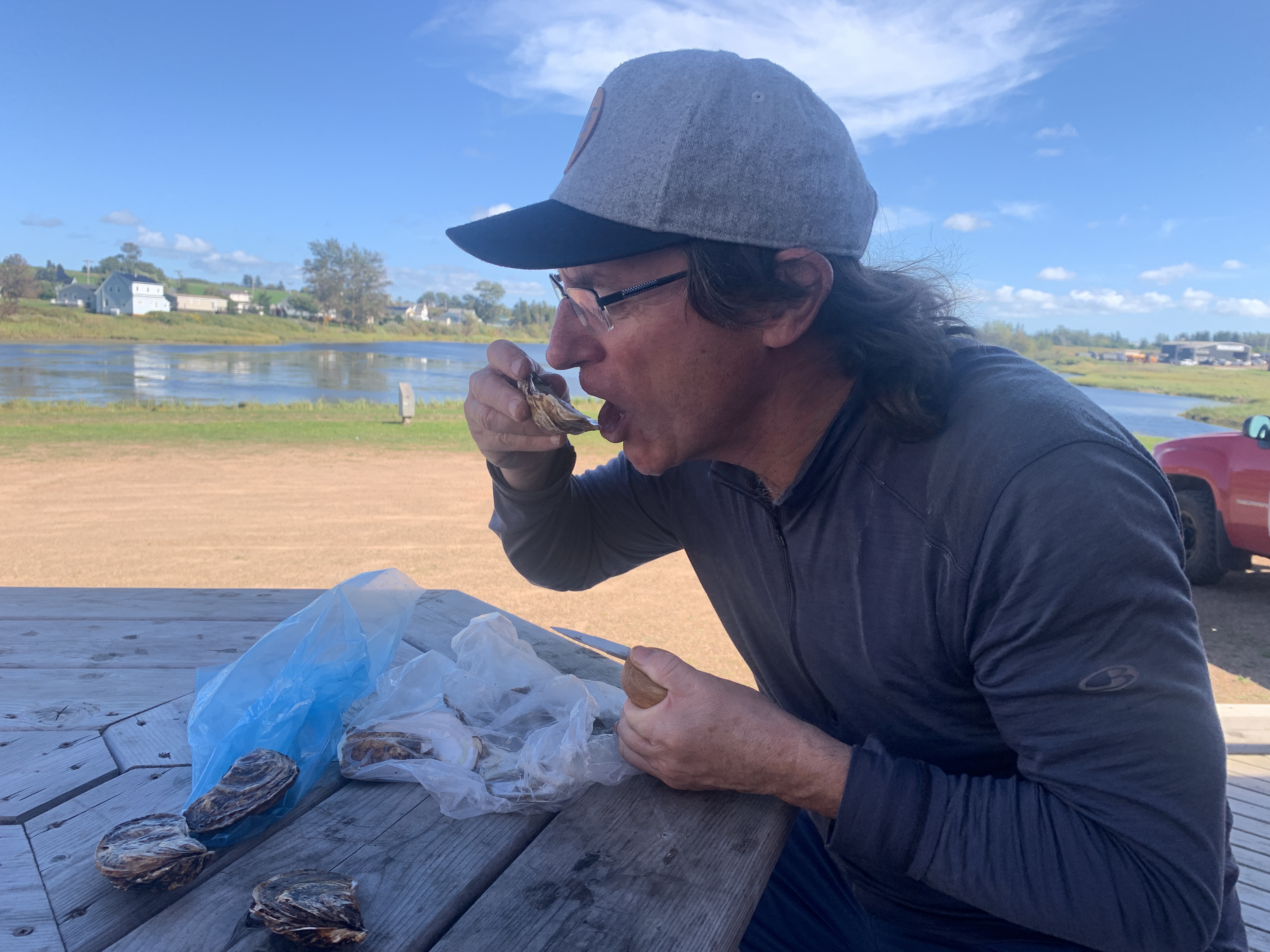
Hardship and suffering, we came to learn, is a badge of honor for TDA riders. The TDA alumni all talked about it and lived it and loved it. Our TDA hardship came in a couple of ways. One was our overnight ferry crossing to get to Amami Island. The ferry left at 6pm and arrived at 5am. There’s no other way to put it, this overnight ferry was inhumanely brutal. Think submarine bunks. No restaurant. No seats. Just the submarine bunks. The only way to eat dinner (we brought sushi) was to sit on deck in the dark in the wind and rain. Gear Guy longed for the comfort of our never set up, MSR Hubba Hubba tent.

We got off the ferry with little sleep (even after a good portion of Japanese whiskey) and got in the saddle while stuffing down some buns and peanut butter in the ferry parking lot, in the dark. Our ride that day was 98kms with 2,400 meters of vertical. Hardship and suffering; badge of honor with TDA. It’s part of the gig. But it’s not all like that. Some days are like a Backroads tour, 5 star. And some days are like an Outward Bound – Basic Training.

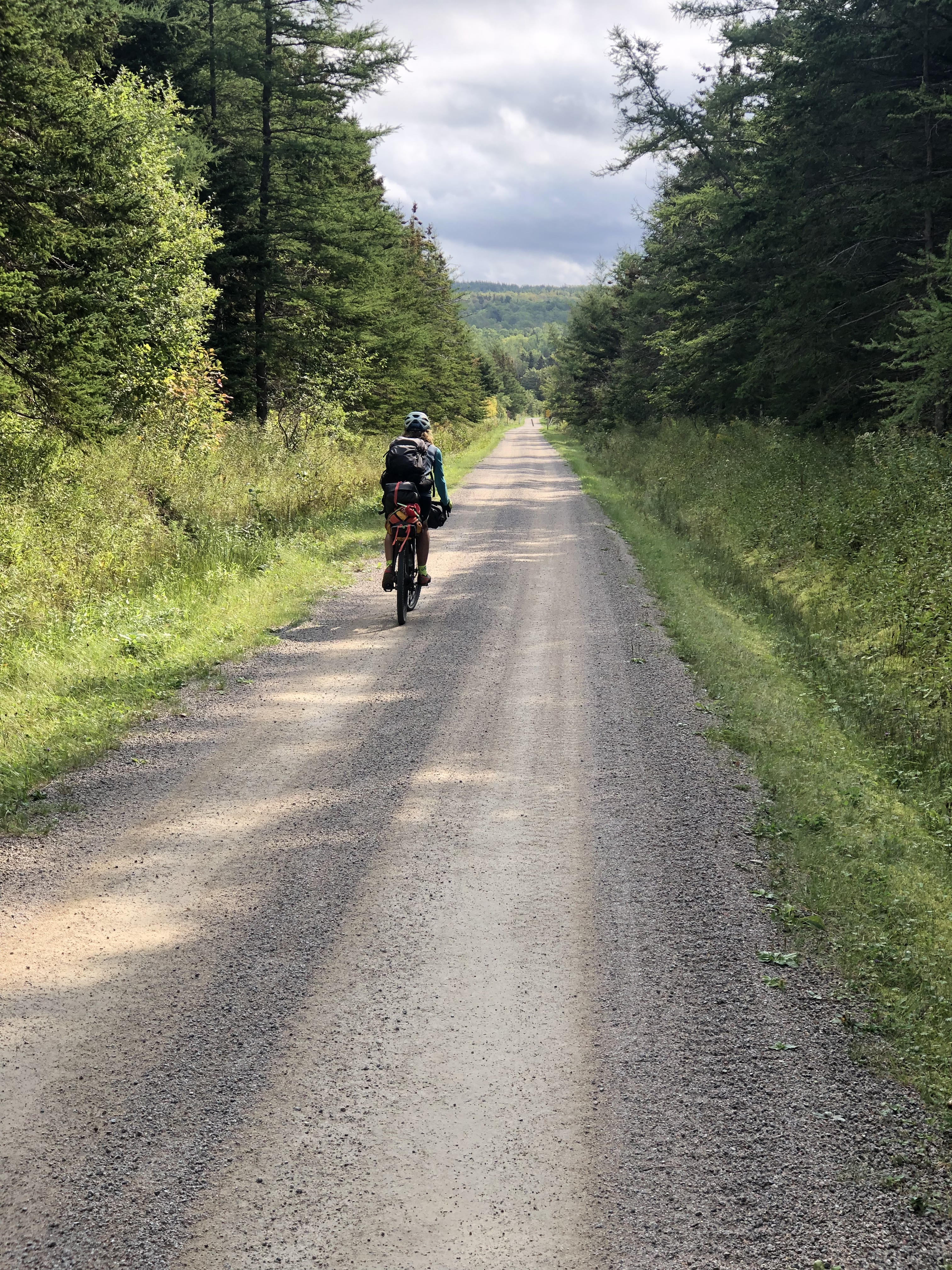
The 3 day ride around Amami was stunning. Fantastic route with no traffic, amazing landscapes and picturesque beaches. Well worth the ferry ride over. But really, we’d fly next time. Or swim. But not ferry.
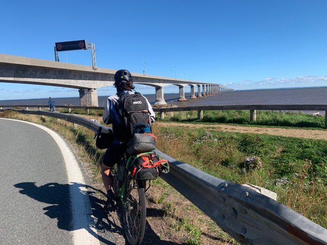
Okinawa Island

We got to Okinawa via a 10 hour ferry. It was a rough sail. It was so rough for the ferry that the Captain even cancelled one of the three scheduled stops due to unsafe docking weather. Needless to say, the ferry ride was a bit sporty. Ergo … suffering. Gravol pills went for a premium.

That said, Okinawa is simply extraordinary; known for its unique culture, subtropical climate, beautiful beaches, and complex history. It’s the largest of the Ryukyu Islands, a chain of about 150 islands stretches from southern Japan towards Taiwan. Okinawa was an independent maritime kingdom with strong trade ties to China, Korea, and Southeast Asia until the late 1800’s when Japan formally and forcibly incorporated the islands.

On April 1, 1945, Allied Forces launched the Battle of Okinawa in order to establish military bases as a launching pad to defeat the Japanese Empire. The invasion force consisted of 82,000 personnel; more than the number that invaded Normandy. The Battle of Okinawa was fierce, resulting in a quarter of a million civilian and military casualties. There were more casualties from the Battle of Okinawa than there were from both Hiroshima and Nagasaki bombings combined. Historians say that this battle was a key factor leading to the use of atomic weapons.

After the war, Okinawa remained under U.S. control until its return to Japan in 1972. Today, Okinawa still hosts 31 US military bases and a 32nd was under construction, resulting in recent public demonstrations. We cycled by one military base which had a wall of armed guards to block its entrance. We whisked by uneventfully and even solicited a smile from one guard. Maybe he was a cyclist. Or maybe he wondered if we thought that the show of force seemed a little over the top? We did. But hey, we’re Canadian. Eh?

We visited the site where the initial landings of the Allied fleet took place. It consists mainly of a Memorial Museum; the Former Japanese Navy Underground Headquarters; and the Urasoe Castle Ruins nicknamed Hacksaw Ridge, popularized by the movie. Interestingly, it was more balanced than the Memorials of Hiroshima. But then, it needs to be said, the Okinawans were a different society to the Japanese before and during the war years and even still to some degree. Okinawans were not only forced as civilians to bear arms and fight for the Emperor but also were prohibited from speaking their native Okinawan language. If an Okinawan was heard speaking Okinawan, he would be executed as a spy. On top of this, there were reportedly mass executions and forced suicides of Okinawans during the battle. As you can imagine, there remains a residue of how the Okinawans were treated by the Japanese during the war. A complicating backdrop to the apparently increasing US military presence.

Nevertheless, Okinawan captivates. There is an energy and spirit different than the other islands. It is the birthplace of Karate. In the 1600’s when Okinawa’s rulers imposed weapons prohibitions, Okinawans developed empty-hand combat methods inspiring the name karate, “empty hand”. Okinawa is a Blue Zone with some of the highest life expectancies and lowest rates of age-related diseases in the world.

The riding there was, well, wet. We travelled into the edge of the typhoon which devastated the Philippines. We have cycled in rain before including the tail end of a hurricane in Newfoundland and a cyclone on the South Island of New Zealand but we don’t recall being as wet as were on Okinawa. The constant menacing drizzle was frequently interrupted with crazy, blinding squalls that felt like someone was dumping buckets of water on you from all directions. This was compounded by a violent wind gusting to 80 mph at times. This continued for a full day and a half before the typhoon left us with clearing skies. Through this we learned a new hack on how to keep iPhone navigation operating during typhoons – a shower cap and hair elastic. Magic.

TDA Report Card

TDA likes to ask newbies like us to describe the tour in just one word. Deb’s word was “wabi-sabi” – beauty in imperfection and balance in asymmetry. Gear Guy’s word was “odyssey”; a long and eventful adventurous journey or experience. It was both.

The route was amazing and, frankly, not discoverable by visitors not familiar with Japan. The TDA routes alone are worth the price of admission. The vertical climbing – well that was gratuitous hardship.

The food was fantastic – varied and authentic. Sometimes a bit TOO authentic for one of us – culinary hardship.

Accommodations were better, on the whole, than we expected. There were a couple that, well, we would have preferred our tent. But really, this is something we encountered on every long haul ride we have done. It’s unavoidable – hardship, that is.

The riders were all amazing and, as we’ve said, “Kindred Spirits”. Each one had an impressive story and history of adventures and of course, hardships. We are amateurs compared with this group.

In the successful TDA model, they preserve the raw adventure while still providing significant structure and organization, a safety net and opportunity for kinship. As our first long haul “guided trip” we’d say they over-delivered in almost every category. We will do another. Can’t get enough hardship.

And now to answer the most frequent question, which ride did we enjoy the most – Canada, New Zealand, Tasmania, SE Asia or Japan? Japan was a tough ride to be sure. It had the toughest vertical per km in all of our long haul rides by a long margin.

The distinct culture and language of Japan was captivating and entertaining at times. It is a land of contrasts – busy modern cities, yet deserted ghost towns; efficiency to the minute, but paper tickets for everything; clean cities, but no garbage cans; a slim and fit population in spite of stores filled with candy; quiet, shy people who simply go wild over karaoke; and maybe best of all, toilets that automatically open rather than solving the true household problem of closing the lid.

It’s a lot to take in.

But when we are asked what ride we liked the most, the answer must be – the ride we happen to be on at the time, because there is always another ride….

Thanks for riding along.

Here’s a comparison of our long haul rides:

  • 2025 Japan – 2259 kms and 36,000 m over 31 days of cycling 16.1 vm per km
  • 2024 SE Asia – 1712 kms and 8500 m over 30 days of cycling 5.0 vm per km
  • 2023 Tasmania – 1540 kms and 19,600 m over 23 days of cycling 12.7 vm per km
  • 2022 New Zealand – 3000 kms and 25, 700 m over 45 days of cycling 8.6vm per km
  • 2019 Canada – 9000 kms and 49,000 m over 100 days of cycling 5.6vm per km

Bicycle and Mind Meanderings

  • Day 15 Onomichi to Osaka Kamizima 68km 566 m
  • Day 16 Osaki to Kure 66km 1000m
  • Day 17 Kure to Hiroshima 53km 427 m
  • Day 18 Oita to Takachiho 111kms 2593m
  • Day 19 Takachiho to Shiba 78km 2368 m
  • Day 20. Shiba to Hitoyoshi 82km 2061m
  • Day 21 Hitoyoshi to Kirishima 68km 2109 m
  • Day 22 Kirishima to Kagoshima 97km 1425 m
  • TOTAL TODATE. 1635 kms 33,260m

The riding continues to be amazing here. But there’s more. If you are into WWII history, this leg of the tour is rife with WWII history. The city of Kure houses one of the largest shipyards of Japan. It was here that the Yamato was built during WWII. The Yamato was (and still is) the largest battleship ever built in the world. To put it in perspective, the Yamato had 50% more displacement than the Bismarck. A massive ship with overwhelming firepower. It was sunk by Allied forces near the end of the war in the Pacific. Historians have said that the Yamato was en route to Okinawa in what was believed to be a suicide mission when it was sunk without ever firing its cannons. Not once. There is an impressive “to scale” monument of the Yamato in Kure. You can stand on the actual recovered Bridge of the Yamato and look down to the Bow section where there is a recovered Anchor. Colored cobblestones mark the impressive Cannon turrets as you peer out at the Bow of the ship. Even if you are not a WWII buff, the site is awe inspiring.

It is noteworthy that Kure is also the home of a large and apparently growing Naval base. The open and obvious impressive collection of Submarines (we counted eight) that are nestled among other Naval war ships is impossible to escape your attention. As we continued our bike travels we observed surface submarines patrolling bay areas and also helicopters flying in formation from time to time. You can’t observe this activity without turning thought to the proximity of Taiwan and the South China Sea. Clearly, these islands are the center of important military and naval bases.

Hiroshima

We all know about Hiroshima. We weren’t sure what to anticipate. Like many folks, we’ve visited memorials, museums and sites of WWII. Auschwitz, for example, can leave you feeling void of soul for days or even weeks afterward. But cycling into Hiroshima was different. It is a sparkling clean city with a bustling, active, young feel. To be sure, the Peace Park and accompanying memorials have an appropriately solemn feel. The park is highlighted by the Atomic Dome, one of the few buildings left standing following the atomic blast in 1945 and left as a memorial. The focus is decidedly on the lives lost and the total devastation left. The theme of the area is a world without atomic weapons. But some might say that there is insufficient acknowledgement of the complexity of the circumstances leading up to the use of the ultimate weapon. Through our full tour of the Peace Park there was just one line in a scarcely visited exhibit about the “questionable National Policy of Japan” at the time. Missing, it is said by some, is any account of the millions of lives lost due to the apparent insatiable appetite of the Emperor for expansion of Japanese territory; which begs the mention of Japan’s attack on Pearl Harbour which provoked the war ending attack on Japan. To this much has been written. That is all to say, some might leave the Peace Park perhaps a little unfulfilled, maybe even bewildered. But perhaps that is the point.

Japan is one of the most volcanically active countries in the world, with more than 100 active volcanoes and thousands of hot springs (onsen). These geothermal zones are used for bathing, heating and even power generation. The city of Kagoshima treats ashfall almost as a fact of daily life, sweeping streets, collecting ash, warning of “ash rain.” Some downtown areas have roofs covering their retail areas! Cycling through many of these areas felt like playing hopscotch in Yellowstone. Spooky to be sure but just daily life in these parts. Since the Fukushima disaster (2011), Japan has increased efforts to expand geothermal energy for sustainable power.

People

Our interactions with locals have been meaningful and unforgettable. We had a young baseball team doing an English chant for the Blue Jays (alas to no avail); the shy lady working at one of the small ryokans where we stayed; the saki store owner who was SO excited we were from Canada; the young children who put on a fantastic drum program for us; the many shy passerbys that cheer us on, but don’t want their photos taken; the patient restaurant staff who slowly explain (AGAIN) in Japanese what it is we can order. Google translate app is indispensable – sometimes a slow process, but it has avoided us ordering horse meat sashimi.

Gear Guy attempting to be Translate Guy

Art

Japan has perfected the art of creating art in everything, everywhere.

Winding our way to the end of our Japanese adventures.

Landscapes, Gardens, Mandarin Oranges …. and Rules

  • Day 7 Shimanto City to Cape Ashizuri 53 km 991m
  • Day 8 Cape Ashizuri to Sukumo 72km 1228 m
  • Day 9 Sukumo to Uwajima 94km 1713 m
  • Day 10 Uwajima to Uchico 78km 1622 m
  • Day 11 Uchico to Matsuyama 67km 1576m
  • Day 12 Matsuyama – Imabari 50km 1017 m
  • Day 13 Imabari – Onomichi 91km 1003 m
  • TOTAL TODAY. 1012 kms 20,711m

The Island of Shikoku will be hard to beat. Endless winding single lane roads through dense forest with scattered valley openings of carpeted agricultural plots as we came down to a beautiful coastal route. Quaint fishing towns in various states of activity were located all along the spectacular coast. Picture perfect.

The fields we cycled through are filled with orchards – figs, kiwi, pomagranets and carpets of rice fields. And Mandarins. Remember those large, seedless, juicy Japanese Mandarins that we all used to get in a box at Christmas time? They’re here. In hoards. It was impossible to ride by them without plucking one or two at a time. Talk about low lying fruit. Ever wonder why those sumptuous Japanese Mandarins somehow got replaced by seedy, small, chewy Chinese mandarins? So do we. There’s got to be a trade deal here somewhere – LNG for Japanese Mandarins. Done.

In Uwajima we saw farmers harvesting Akoya pearls from oysters – we think. The conversation was somewhat lost in translation. But this area is well known for its pearl production and it didn’t look like the fisherman we “talked” to was fixing on getting em ready for shucking and eating.

Temples, shrines and castles continue to dot our path and we enjoyed an annual fall celebration with some locals.

The Shimanami Kaidō is a world famous cycling route, and it provided our gateway off this wonderful island. The pathway connects Japan’s main island of Honshu with Shikoku, crossing the Seto Inland Sea via a chain of islands linked by spectacular suspension bridges. We were not the rare cyclists here. Hundreds of locals and visitors on rental bikes flock here to ride this bridge circuit. No wonder, the infrastructure to create this dedicated cycle path is impressive, with on and off ramps dedicated to cyclists. A classic example of “if you build it, they will come” with over 300,000 cyclists riding the route annually. Check it out on Relive below:

Shimanami Kaidō

Wildlife has not been a highlight of the trip so far, except for Jay’s night at a Japanese whiskey bar followed by karaoke antics, but we have had a few brief sightings of Macaques, deer and a few live snakes. We saw the 6 foot black Rat Snake below (not venomous) and another person saw the Viper (super venomous). The Macaques have been very shy and take off quickly.

The art of Japanese gardening and Niwaki Pruning

We cycle by manicured trees and shrubs in spectacular home gardens. Japanese gardening and tree trimming (niwaki pruning) is an art that is deeply rooted in aesthetics, philosophy, and cultural tradition. It’s not just about creating beautiful landscapes but also about shaping nature in a way that reflects harmony, balance, and simplicity. There are several types of gardens, such as Zen gardens with only raked gravel and rocks meant for meditation. Tea gardens surround tea houses and use stepping stones, lanterns and water basins to create artful appeal. Hill and Pond Gardens use water, rocks and trees to appeal to each sense of the strolling person. These gardens are totally captivating. We stop often just to capture another one.

Niwaki refers to the art of pruning trees to enhance their natural form while fitting them harmoniously into the garden. They are like living paintings. Shapes are inspired by natural tree growth, often mimicking how trees weather over time in the wild. Japanese garden design and tree pruning follow core principles of wabi-sabi (beauty in imperfection). Balance is achieved not by symmetry but by dynamic, irregular forms. See Jess? There is balance in asymmetry.

Rules

A word about rules. In Japan, rules aren’t just followed — they’re practically worshiped. People wait for the crosswalk light even when there is not a single car in sight. At events or even getting into a restaurant, people stand obediently in perfectly straight lines, as if auditioning for a synchronized waiting competition. Even cats use a crosswalk.

The Japanese philosophy on order, rules and social harmony is deeply rooted in centuries of cultural, philosophical, and religious influences — particularly from Confucianism, Buddhism, and Shintoism. It emphasizes not just obedience to rules, but the cultivation of a harmonious society where order arises naturally from mutual respect and shared values.

In our experience, this love of rules means that most questions are answered with “no”. If you need reservations for a restaurant (or gym!) then even if it is empty you can’t go in until they put your name on the reservation list, give you a reservation time in 3 minutes, then call your name, Seinfeld style. All with no lineup. And if you want a cold beer at the end of a long biking day, don’t ever go to a bar your bike shorts and carry a helmet. You won’t get a beer. It’s a rule. No drinking if you are dressed like you might be biking or driving. Never mind that you can buy a beer from a vending machine, like, anywhere. If you “dress like a bike” you ain’t getting a beer from a bar. It’s a rule.

And then there are the slipper rules. Slippers are everywhere in a Japanese hotel. You walk into the entrance way of your hotel room and there are slippers. It is a rule to take off your outside shoes and don slippers to step inside the room. And if you go into the bathroom (with the attention seeking toilet), there is a pair of slippers for you to don so that you do not bring particulate into the bathroom or, heaven forbid, from the bathroom to the rest of the hotel room. So it is a rule to take your previously donned slippers off and put on “toilet slippers” to use the toilet. And then change back into your “room” slippers to go back into the hotel room. If you happen to inadvertently wear the bathroom slippers out of the room – well, a diplomatic incident.

The Japanese are also HUGE baseball fans. We visited a small sake shop and when the owner found out we are from Canada, we had a very animated discussion about baseball – by the time we left we had converted him to a Jays fan (but he was clearly an Ohtani follower).

GO JAYS GO!!!

TDA Apprenticeship on the The Island of Shikoku

  • Osaka city tour 17 km 119m
  • Day 1 Naruto – Kamiyama 63km 855m
  • Day 2 Kamiyama – Iya Valley 88km 2387m
  • Day 3 Iya Valley – Lake Sameura 74km 1835m
  • Day 4 Lake Sameura – Mt Ishizuchi 68 km 2139 m
  • Day 5 Mt Ishizuchi – Tengu – 93 km 2522 m
  • Day 6 Tengu – Shimanto City 104 km 1704 m
  • TOTAL TO DATE: 507 kms 11,561 m (Average of 1927 meters of elevation per cycling day – according to Ride with GPS, notorious for being high, but that’s what we’re going with)

And we’re off – traversing 7 islands in 44 days with TDA Global Cycling – the creation of Henry Gold from Toronto (Initially named Tour d’Afrique after their first and namesake trip). As our Japan trip is a new addition to their unique list of tours, Henry has joined us on this trip. He is an encyclopedia of bike packing on a global scale. He is happy to hear riders’ comments and suggestions for improvement, but usually replies with “Well after 23 years, we think we are ok doing it this way.” We are only beginning on this ride and we are still processing but the model does indeed seem to be working. You see, Founders sometimes lie, but the numbers never do. Over 60% of TDA clients return. In fact, several people have signed up for additional trips during this first 10 days! And trips of 30+ riders for long haul cycling are booked well in advance, often over a year in advance. We were lucky to get the call up as “Newbies”.

The Cyclists

30 cyclists – only 8 first timers to TDA. 1/3 Canadians. 1/2 couples. Age range from 55 – 82. Inspiring life stories, fitness and personalities. In 10 days we have biked, eaten in our yukatas (dressing gown), played games, sang at karaoke bars, shared stories and showered together in onsens (girls and guys separately) and eaten unknown items at our dinner table. The universal love of long haul bike touring is our common ground. Kindred spirits you might say.

The riders are strong and eager. A bit intimidating as such. Not a group to try and beat at anything. Even after rising to our daily 5:30 am alarm a group of riders will often hit the road before we’ve finished breakfast. One Rider is a retired Drill Sargent for the Danish Army. He leads a team we affectionately named the “Dane Train”. After a 100 km ride and 2,500 Meters of vertical he’ll gladly go for a 3 km swim in the ocean. Know what we’re saying?

The Route

As we had investigated doing this trip on our own, we have discussed what it would have taken to find these TDA routes we’ve have been on so far. “Impossible”, says Nav Guy. Katsu is our local guide. A gentle ole soul. He speaks in a tone that almost makes you sedate into a hypnotic state. Katsu spent weeks in cars, trains, ferries and bikes finding this route. He knows the areas, the town folk, the language and the local customs and folklore like the palm of his weathered hand.

The result? Seemingly endless, winding, narrow, forested, moss covered routes with breathtaking views. All seemingly custom made for cycling. No people. No vehicles. Occasional long climbs but rewarding – mesmerizing downhills. Admittedly, the Island of Shikoku is not a typical tourist destination; but really – where is everyone?

Km 25 – 45 was a blissful, twisting, quiet single lane road.

We have been shocked at the lack of population in this mountainous area. It’s a bit eerie. Many homes are deserted and even the few cities we have been in, homes and shops are boarded up. Apparently one explanation was during the boom years of the 80’s the government was building infrastructure outside the major cities to encourage the younger population to stay or move there. With oil price and interest rates increases, the economy stagnated and people actually moved to the cities on mass. Some stats show the population of the country is now 91% in urban areas. Sad to see the empty homes but it certainly has left a cycling Mecca for us bike folk.

The population of Japan was as high as 128 million in 2010 and it has dropped to 122 million currently. With the current birth rate of 1.3 children per woman, locals say that drop is destined to continue for some time.

Accommodation

TDA builds routes around biking, not accommodation. That fits our style, so we were prepared for small and VERY simple. So far only 1 room would not pass the “Tent” test; that is, we’d rather be in a tent. It was bit damp. And cold. And there were shared bathrooms and showers. Okay, it was a bit more than damp. Gear Guy opened an umbrella in the middle of the night, “Is it raining?” Sleeping on the floor in a traditional ryokan is fine, as long as there are 12 inch cushions.

The Food

The food continues to amaze. Our dinners are a formal Japanese style – with many, many, many small dishes of interesting, often unknown items. The raw eggs and whole fried fish for breakfast are awesome for only one member of our team. But the presentation and the flavours are incredible. Even our roadside lunches are delicious, but they are usually at the top of a hill after 70 kms so they could serve just about anything.

Cultural Tidbit

Japanese forest bathing, known as Shinrin-yoku is a practice that involves immersing oneself in a forest environment to promote relaxation, reduce stress, and improve overall well-being. It’s not about hiking, exercising, or accomplishing anything—it’s about being present in nature and engaging your senses. So, “forest bathing” means bathing in the forest atmosphere, not with water, but with your senses. It was developed in the 1980’s as a response to growing urban stress and tech overload and is now part of Japan’s national public health program. Maybe they are onto something?

Art

We are not experts when it comes to art, but the Japanese can turn anything into an art form: Sumo wrestling, gardening, architecture, food, roads, bridges, manhole covers and yes, even attention seeking toilets (thanks Gord)…

Land of the Rising Sun

Also The Land of:

  • 123 million people. That’s 3 times the number of people in Canada. Moreover, Japan has a land area of 377,975 sq kms compared to Canada’s 9,984,670 sq kms. That means that Japan is about 80 times more populated per sq km than Canada.
  • the most populous urban area in the world with Tokyo metropolitan area home to over 37 million people.
  • many, many islands – there are 4 main islands and 6800 smaller ones. No wonder there were reports of Japanese soldiers being stranded on a small island many years after the war ended without knowing that the war had ended.
  • 80,000 Buddhist Temples nationwide. And if you get bored of Buddhist Temples, there are another 100,000 Shinto Shrines! Gear Guy loves Temples and Shrines!
  • the Shinkansen bullet trains run at almost 300kmph and are famously on time. A delay of even 1 minute comes with a certificate of apology
  • toilets with a heated seat, bidet, dryers, music…. Jay takes a pillow to the can.
  • politeness is a way of life – bowing is a traditional gesture used to greet, apologize and show respect
  • more Michelin-starred restaurants than any other country
  • slurping noodles is good manners
  • one of the highest life expectancies in the world – women 87 years men 81 years. May be directly correlated to politeness, eating good food and slurping?
  • 4 million vending machines – selling everything from drinks, umbrellas, eggs and hot meals. We ordered two warm beer from one. Yum.
  • about 1,500 earthquakes a year, most minor. Buildings and trains are engineered with advanced quake-resistant technology.

We’re stoked to start a bike packing trip we’ve craved for some time now…… Japan.  We arrived in Osaka on September 23 and we’ll be in Japan for 2 months. Our planned bicycle route will take us around 2500 km and over 46,000 m of elevation in 44 riding days. Apparently it’s hilly in Japan.  There is more vertical per km than there was in Tasmania; which was slightly more per km than New Zealand and SE Asia; which was slightly more than Canada.   The upward hockey stick vertical per km trend is making me wonder if our unanimous route voting system actually works. But here we are.  

We approached this trip a little differently than in the past.  Our travel plan for long haul rides pretty much consisted of 1. Buy a one-way ticket; 2. Get off plane; and 3. Start riding.…. No reservations, no distinct route, just a general direction. But there are three things that made us switch it up for Japan. First, though we tried for months, we couldn’t find anyone to assist us with routing a long haul bike trip in Japan. Long haul bike touring is still in its infancy in Japan it appears. There are certainly you-tubes of biking dudes riding Japan’s four main islands tip to tip, but invariably they end up at one time or another in a paralyzingly frightening Japan tunnel with no shoulders, no lights and massive trucks. There would have been some serious team discourse if we got trapped on a tunnel like that. Nough said. The language barrier is another thing. Google translate is an amazing game changer, but there is still a lag when it comes to bike touring routes when trying to convey what we are looking for. And the last thing is that we find the population density rather daunting to construct safe bike routing. All that to say that we joined a Canadian bike tour company – TDA Global Cycling. We have been following TDA for awhile now. They make no bones about it. It’s a bike trip, not a hotel trip. Accommodations are decent for the most part they say. Seems to suit our style. But it’s new for us. Call it an experiment. We’ll let you know how it works out.

We had a week prior to getting in the saddle, so we were sightseeing in Tokyo, Kyoto and Osaka. Japan is astonishingly clean and unexpectedly quiet. Even the garbage trucks are new and clean, looking more like RVs than garbage trucks. It seems there are no horns in vehicles because you just don’t hear them. Loud noises are considered impolite. One other observation about Japan – it’s also unnervingly friendly.

Busy, crowded, yet calm and organized – Shibuya Crossing, Tokyo

We saw a lot of temples, shrines, palaces, shogun homes, gardens and forts. Not Gear Guy’s favourite list of activities. The tour of the National Museum on the other hand was outstanding. Ancient displays of artwork, tools, weapons and naturally, Samurai swords. Fascinating that ancient Japanese paper, called washi, is known for its durability, resulting in preserved scrolls dated from the 1300’s. There were also displays of pottery from 300 BC. All wonderfully choreographed. It was perhaps fortunate there were no Samurai swords on display in any of the Temples or Shrines or “I’m done with Temples” Guy would have surely opted for an honourable self-dispatch by Seppucu (or Hará Kari). That, or perhaps I would have just handed him a sword.

“Only 1 more temple today Jay”

The Samarai dynasty which ended “only” 150 years ago after ruling Japan for over 700 years, feels like yesterday – its influence everywhere.  We inquired if we can still train to be a ninja.  Apparently, we both (even Gear Guy) have a better chance of getting in as a Geiko (geisha) as none of the young Japanese girls want to do the training any more. Which gives you some idea of how hard up they are at attracting Geisha apprentices.  

Thank you Andrea for the ubiquitous custom Fernie hat that Jay won’t remove!

The only place on our planet where sumo wrestling is “officially” practised is in Japan, a cultural phenomenon that has been going on for thousands of years. There are about 600 wrestlers in Japan, mostly Japanese but some from Mongolia and elsewhere. There are about 45 “stables” in Tokyo where typically 14 wrestlers live, eat train and compete together. We attended an up close and personal Sumo wrestling practice. Maybe too up close and personal? To say that Sumo Wrestlers are big, strong and powerful is like saying MacDavid can score. It’s not saying enough. Sumo Wrestlers are also startlingly fast, flexible and agile. I mean, they can move like a drone. As they accelerated their massive bulk forward and laterally they would kick up sand and dust on us spectators sitting around the Sumo Ring (the dohyo). Sumo wrestlers also sweat. They pour sweat. Like a race horse. Sweat travels. By the end of the session, it was us that needed a bath!

The wrestlers are big. Did I mention that? It made Gear Guy conjecture about the size of the Mothers that gave life to these monstrous lads. Like, congratulations, you have a bouncing baby boy weighing in at 25 lbs, 3 ounces.

Spot the wrestling Toy.

Kyoto was enchantingly Zen like – more traditional – no buildings over 10 stories so one can see the mountains surrounding the area.  Enjoyed a Geisha dance, amazing strength and poise – but we were glad it didn’t last all day.  Some more than others. Went to a tea ceremony which was filled with rules which we found entertaining even though they were not meant to be.  Jay balanced this off with a double Sake tasting afterward.

The food – oh my – the food. Already declared “The Best Sushi in the World” we have eaten sashimi, sushi, tempuraed unknown items, yakisoba, takoyaki, okonomiyaki, kushikatsu…

Some of us ate more questionable items:

We signed up for a cooking class – how hard can it be given the food is mostly raw? This is my kind of cooking specialty! We loved the experience, but it is very clear to us now why the Japanese population are very trim in apperance. The cooking process for Japanese food is painstakingly, well, painful.

Osaka has a very different feel – young, vibrant with lots of nightlife we happily avoided. World Expo here we had planned to see is decidedly overcrowded, which is intimidating given the crowds we have already run into. Apparently people with reservations were not getting in for 3 hours and then it was a 7 hour wait to get into a pavilion.  We spoke to a couple that confirmed the reviews I had read and not shared with Jay – including:  “I even had to queue to write this review”. So we wandered around Osaka, marvelling at the sights.

 Next update – from the saddle.

Circumnavigating Tasmania

Tasmania (not Tanzania, Africa where it is warm and dry) is an island state of Australia. Named after its first European (Dutch) discoverer, Able Tasman, it is affectionately known as Tassie or Tas. Tassie is located 240 kilometers to the south of the Australian mainland. Sounded warm. Gear Guy booked flights suspiciously quickly while I continued reading and realized it is also only 2500 kilometers from Antarctica. We loved cycling the Aotearoa Trail in New Zealand just last year. But really, it was New Zealand where we unwittingly began our experimentation into the Wim Hof “cold therapy” lifestyle. We loved New Zealand. But we froze. We decided we needed to find warmer routes, yet, here we are – heading just north of Antarctica in the spring. And then there is the wind. Tasmania is located directly in the pathway of the notorious “Roaring Forties” wind that encircles the globe. There’s more: “Spring (November) is generally the windiest time of the year with afternoon sea breezes starting to take effect on the coast.”

Tassie is Australia’s least populous state, with less than 600,000 people in around 68,000km2 (about the size of Ireland). The state capital and largest city, Hobart, holds 40% of the population. Healthcare is listed in the top 5 industries and the number 1 employer on the island – I am suspicious this has something to do with the venomous snakes and spiders found throughout the island. An impressive 42% of the entire island is protected as a national park or World Heritage Site. Spiders and snakes love protected parks.

Initially, I assumed that the poisonous wildlife were left on the mainland when Tasmania broke away about 12,000 years ago. But no, 3 deadly snakes are indigenous to the island, the Tiger snake, the Lowland Copperhead, and the White-lipped. Our trip outfitter provided detailed information on what to pack in our first aid kit to help prior to emergency services arriving in the many remote locations we will be biking. “You know, for snake and spider bites and stuff.” The Looney Tunes Tasmanian Devil, the world’s largest carnivorous marsupial, is common in Tasmania – well relatively. It is extinct everywhere else in the world. We are told that although the Devil is aggressive, it is not a danger to humans. Just like Canadian bears. Our good friend Curran was kind enough to point out that quolls can be quite aggressive as well. What’s a Quoll?

According to Wikipedia, Tassie is known as a place for unorthodox place names: like Bobs Knobs, Nowhere Else, Ouse, Egg and Bacon Bay, Doo Town, Hell’s Gates, Cramps Bay, The Nipples, Cape Grimm, Blubber Head, Chuckle Head, Bottom Hole, Secret Hole, Humungous Hole, Guys Dirty Hole… Lots of references to one’s Bottom – like Stumpy’s Bottom, Deep Bottom, Round Bottom, Officer’s Bottom, Grassy Bottom, Boomers Bottom, Prickly Bottom… Perhaps if you make a donation to a local conservation group, you can have a rock named after you; like, Gear Guy’s Bottom.

We’re doing things a bit differently on this tour. We’ve enlisted Manfred from Green Island Tours to help plan our routing and accommodations around the Island. Finger pointing about wrong routes and poor accommodations will all be targeted at Manfred. And, after carrying a tent for 12,000 km across two countries without setting it up even once, we are not bringing a tent on this tour. I’m perfectly fine with this adjustment, Gear Guy feels a bit naked. According to Gear Guy’s First Rule of Touring – the only time you need a tent is when you don’t have one. And even though we donned our sleeping bags many times in Canada and New Zealand, those too, we are leaving behind. No cooking gear either. Many of our planned accommodations have kitchens or kitchenettes. Sure they do. But we’re going lighter weight on this tour as a test, to our marriage.

Our friend Gord suggested we try bike packing a country that is warmer, flatter and smaller. Warmer? Probably not. Flatter, well, no. Tassie actually has more vertical per km than New Zealand; which was more than Canada. But – Tassie is in fact smaller! Our route is about 2,000 km. New Zealand was 3,000 km and Canada was 9,000 km. So 1 out of 3 ain’t bad.

We will cover the 2000kms over 22 riding days – so we have several planned days off – good news. Math tells me our daily average is expected to be around 100kms. We averaged 90 kms per day in Canada and about 75 kms per day in New Zealand. But we’ll have less weight on this one – also good news. So, 100 km per riding day isn’t looking too bad, but the elevation on many of these days exceeds 1200m – ahhhh – there’s the bad news!

So why Tasmania? When we were bike packing New Zealand last year we ran into a fellow bike packer who said, “If you love New Zealand then you’ll love Tassie”. Characteristically, that was sufficient due diligence for Gear Guy to book tickets….. “Bike packers don’t lie.”

My 93 year old Mom just gave me a mild case of Covid from which we are both now (mostly) recovered. Jay just had emergency eye surgery – but had the best possible outcome. Clearly it is time for more bike packing (mis)adventures and exaggerated stories of same. As always, you are most welcome to join us.

G’Day Mates

Sandy Beaches to Kauri Trees to Sheep – Powered by Meatpies – The Northland

  • Day 1 – Cape Reinga – Hukatere Lodge 75 kms 180 m
  • Day 2 Hukatere Lodge – Ahipara Bay 36 kms 25 m
  • Day 3 Ahipara Bay – Rawene 68 kms 1178 m
  • Day 4 Rawene – Omapere 25 km 156 m
  • Day 5 Omapere – Trounson Park 54 km 1070 m
  • Day 6 Trounson Park – Dargaville 37 km 86 m
  • Day 7 Dargaville – Pararoa 52 km 407 m
  • Day 8 Pararoa – Glorit 78 km 1260 m
  • Day 9 Glorit – Waimauku 39 km 632 m
  • Day 10 Waimauku – South of Auckland 65km 517 m
  • TOTAL TO DATE: 529 KM (length in kms) 5511 M (cumulative vertical meters climbed)

New Zealand is a ways from home – 27 hours – 3 flights. We arrived uneventfully in Auckland – with all our luggage intact! Jay slept 10 hours on the plane with the help of Nyquil and The Hobbit. He seems to be mostly recovered from the covid. No one asked us about the covid. Customs Agent was more interested in the cleanliness of our bikes and camping equipment and was especially curious why we brought tea. Jay commented that Red Rose was only available in Canada and what a pity that is. The Agent waved us through. Not even the Customs Beagle was the slightest bit interested in Jay’s Red Rose tea.

We assembled the bikes in an airport hotel, rented a car and searched for a post office that would ship our bike bags to Invercargville via Post Restante – a New Zealand postal service where they will hold parcels for pick up for a fee. Great concept, but no-one at 3 post offices seemed to have heard of it. We shipped them anyways.

Ignoring the locals talk about the wettest winter on record and national news alerts about snow on the South Island, we met our shuttle driver and headed north on a spectacularly beautiful seven hour drive to Cape Reinga.

Cape Reinga, the most northerly point of New Zealand. Where the Tasman Sea and the Pacific Ocean clash. Reinga is the Māori word for underworld – refering to the Māori belief that the cape is the point where the spirits of the dead enter the underworld. Definitely not a family swim spot. If it looks cold and windy. It is.

We loaded our bikes and started south to Te Paki Stream “Road” – a tourist name for Te Paki “Stream”. Definitely an inside joke Kiwis chuckle about over a pint during rainy season.

Te Paki Stream “Road”

We did eventually reach 90 Mile Beach – another Kiwi joke – it’s really only 55 miles. Spectacularly beautiful and spectacularly slow – top cruising speed was 12 kms/hour – we learned not to stop and chat with trampers too long, or our tires quickly sank into a cement like trap of sand.

We have yet to meet fellow bike packers, but we met many trampers on the beach – there is a different route for trampers, but we start off together. The Te Arotearoa walk will take most 5 1/2 months. We met a diverse assortment of people hiking: families, singles, old, young, Europeans, Canadians – but they all had blisters in common. We did feel slightly bad as we passed them on bikes and we did not discuss one Kiwi’s ominous comment: “yeees, I thought about biking, but it’s too darn hilly heeeres.” We overnighted at the off grid Hukatere Lodge just off the beach – and the wonderful owner Gabi miraculously stuck a cold beer in our hands and some New Zealand chow for dinner. That sounds simple. But a lot had to go right for us to make that lodge. Otherwise, we would have been in a tent. Gear Guy was betting on the tent. He underestimates me. My record of no tenting remains unblemished.

We basically had the beach all to ourselves, but occasionally a vehicle looking for the perfect fishing spot would whoosh by. But the beach is huge. And at low tide there is heaps of room for all. No traffic signs needed.

Loved riding on the beach for 2 days, but once you hit a paved road, you realize how strenuous it is! On to farmland and into Kauri forests. Kauri trees are only found in the north of New Zealand, and unfortunately many are dying from the scientifically creative name of Kauri Die Off disease. We stood in awe of the 2000 year old Tane Mahuta, the oldest living Kauri. Trunk girth of 13.8 meters! We waited for the only other tourist to finish videoing the tree growing so we could get our requisite photo. We’re among the first cylists. Locals seem glad to see us. Or anyone for that matter. It is apparent that the lockdown in New Zealand (especially the Auckland one) was very nasty for all and there are some lingering hard feelings about that. We ran into a number of locals quite anxious so share their, shall we say, rather assertive views on government, Covid and lockdowns etc…. We just played the “Canadian Card”. Hey, we’re just here to ride our bikes, see your Country and eat some meat pies! We have nothing to do with Justin and Jacinda being besties.

We visited New Zealand with our kids in 2003 during a 6 month sabatical – I had forgotten how upside down things are to what we are used to. Light switches are reverse, south means colder, Christmas is summer, the north is tropical vegetation and traffic drives on the left. Surprisingly, I quickly became accustomed to cycling on the left with my helmet mirror on the right. Until I stop to take a photo and panic that the cars barrelling towards me are on my side of the road. Then I am fine until I need to turn right and I have no idea where to look. Then I get back in the swing of things until I ride up to a round about – that just does me in. I walk.

Kaipara Harbour is the largest harbour in the Southern Hemisphere. As recommended for the route, we had cleverly booked a 3 hour boat shuttle along the length of it to avoid 3 days of less desirable bike miles with Auckland bound traffic. The day we were to head down the peninsula to meet our ride, the boat owner Terry advised us he was covid positive. No one else drives his boat. No one else shuttles people. No fishing charters will take you. “There are no other alternatives.” So we stoically biked around the long way. There were marvelous perks of this route – The “World Famous in New Zealand” Kauri museum; Deb at the Old Post Office Guest House and Sharon and Shane at the Kaipara Views Eco Lodge almost made the Auckland bound traffic bearable. Oh, and the glow worms and shrieking eels. Everyone knows “the shrieking eels grow louder when they are about to feed on human flesh.”

We’re not sure, are Kiwis known for their cuisine? Seems to us If it is not deep fried, then it is enclosed in pastry and called a pie. Our record is 3 pies in one day. In the North Country we struggled to find grocery stores with much more than our 7-11 selection of vegetables. Fish and chips is readily available, but we have tested it and it is not the best fuel for biking…. And we’re trying to keep our emissions down so as not to get taxed. But will continue to search out fish and chips as good as the Digit’s Fabulous Walleye (Jay’s Brother’s World Famous in Canada recipe). And the meat pies. Did we mention the meat pies? They vary in quality. Steak can mean bologna.

Speed limits – more Kiwi humour

Our initial perception of riding here in New Zealand is there are no free miles. Every kilometre is earned – up and down with no flat in between. Looks like an unhealthy EKG chart rather than an elevation graph.

We are standing (peddling) many of the steeper hills in first gear and then braking on the way down due to traffic or gravel. We had 10 days in 9000 kms of riding Canada that were near or over 1000m of elevation and we have already done 3 here. And we’re only on day 10. 500 kms in 10 days and feeling a wee beat up. Leaving Northland and heading for a beach for a day or two off.

Epiblogue

9000 kms 100 days of riding

We arrived in The Miramichi, our destination, not a minute too soon when the cool, dreary, heavily clouded skies opened up in a now familiar maritime downpour. This storm, locals warned, “would be witt us pour awhiles”. Our original thought was to “close the gap” in Miramichi and then, weather permitting, continue to ride westward as far as Montreal perhaps. We took the stormy weather as a sign. That, and accommodations, restaurants and even grocery stores were closing due to both seasonal closures and Covid related labour shortages. These are all mandatory elements for us bourgeoisie travelling cyclists. So instead of continuing, we took a few days to count our blessings, re-group, and, finally, decide to end our cross Canada bike adventure in The Miramichi. From St. Johns, Newfoundland to Miramichi, New Brunswick, we rode about 2,000 kms in 26 days. We originally estimated this stage of the ride at about 1,200 kms but we did almost that distance in Newfoundland alone.

We apprehensively drove by the scene of the 2019 crash. Gear Guy remembers it well. Me, not so much. It is now a very nicely manicured section of pavement. The impact dent is gone and forgotten by most. We reached out and thanked Jason and his team that helped us through that day and also to the family that received a Freedom Concepts bike. Then we stole the sole rental vehicle from a poorly guarded Enterprise dealership and pointed homeward.

Our retirement goal was to gravel bike across Canada on routes less travelled. Canada does have a deluge of bike routes as diverse as the country itself. Start in Victoria end in St John’s. How hard can that be? We delighted on beautiful gravel roads, suffered on unpassable animal trails, and noticed millions of details beside us that we would miss if not on a bike. You may not see as much on a bike, but what you see, you see, feel and experience deeply – whether bone rattling gravel or people sharing a cold beer. You gotta take the good with the bad.

We started out with a plan to average 80 kms per day but ended up with an average of 90 kms per day. Our main route finding app was GAIA, a backcountry app suggested to us by Steve K, for which we are eternally grateful. If you cross Canada via the Trans Canada Highway, you would travel about 7,800 kms. Our back roads and trails route included diversions to visit friends, family and to buy beer, but also the occasional mis-step by Nav Man, took us 9,000 kms.

“Oh the places you’ll go and the people you’ll meet.” Dr Seuss.

The much complained about mis-steps are estimated at about 500 kms including 2 un-passable fences with barbed wire, 2 dead end paths with un-passable rivers, one compete Zen out moment west of Ottawa that took us about 75 kms out of the way in one day, and about 20 times where we were just, well……lost. But like learning how to work the PVR, there is no point in both of us navigating, so Nav Man is thrown under the bus here.

Mis-Steps

We learned that if you are bound and determined to bike across Canada without ever taking a main road or highway, you could do that – mostly. But it’s desperately naive to think you could do that without ridiculous challenges. Like 3 kms of knee deep snow on Coal Creek Road east of Fernie. Or the impassable so called “Trans Canada Trail” in Northern Ontario. Or the rail trail in Newfoundland where the trail is, well, you know. And of course Manitoba, where gravel roads are plentiful, but mainly in non-contiguous, anti-geometric patterns seemingly designed to confuse. In the end, we believe we crossed Canada as back road as possible given our general routing, type of bikes, aversion to riding in tornadoes, hurricanes, heavy snow or horizontal rain. Which left – hot, cold and headwinds. Our well considered estimate is that we accomplished about 75% of the kilometres off main roads.

All our days were fantastic but some were fantasticer.

Our Top Biking Province list includes – British Columbia, Saskatchewan, Quebec, Nova Scotia and PEI. An absolute joy to ride in with bike paths and back roads practically everywhere.

The Provinces and places we would not bike again (at least not the same route) are Manitoba (ridiculously pathetic roads with steep gravel shoulders everywhere); Northern Ontario (as bad as Manitoba but with more traffic); Newfoundland (we loved the people but the rail trail (as we were warned) is only for the most masochistic of riders).

Here’s some of our observational trivia about stuff that we noticed as we rode:

  • In BC we noticed a strong scent of marijuana by an astonishing number of passing vehicles. This strange phenomenon did not appear anywhere else.
  • Worst vehicles and worst drivers on the roads are hands down – half ton trucks and the people that drive them. Many have 6” exhaust tail pipes, apparently compensating for something. Now, it should be noted that Gear Guy drives a half ton truck but he promises his truck comes with a standard exhaust system.
  • PEI has more tractors per capita than anywhere. If there is a tractor heaven, it’s in PEI.
  • In Saskatchewan, several farmers or retired farmers stopped to chat with us in the middle of nowhere. One thought we were lost. We were, but denied it. Another, Bob, we still enjoy regular contact with. A retired farmer who pilots his own plane and has a passion for electric vehicles and planes.
  • We carried our tent for 100 days and didn’t set it up once – “It’s a bike trip not a camping trip” we kept telling everyone. But carrying it gave us the confidence to try some routes that MAY have required an overnight. During the 2 year gap in our trip, we discovered that we had carried a leaky tent for the first 7000 kms, so it was a good thing we didn’t need it.
  • We also carried a dried Beef Stew meal for 9000 kms. Expiry date is 2087 so perhaps next trip?
  • Our accommodations varied greatly, some inadequate for humans. Like Spruce Woods, Manitoba. There, Gear Guy chose to sleep in his sleeping bag on a broken table rather than on the sleeping cots provided. In fact, we donned sleeping bags several times – prophylactic style. But really, there is nothing like a hot shower and a cold beer at the end of a ride. So we put up with a lot to get both at the end of the day.
  • Best beer we ever had – like, ever. Annica somehow found and rescued us with ice cold beer in her van when we had one of our mis-steps and found ourselves in the middle of a jungle of pterodactyl size, swarming, biting, knawing deer flies near Muskoka. Never have two people lost so much blood, so quickly, by such crazed, blood thirsty insects as we did that day. We practically needed stiches to sew us up. Really, only tripping into a pond of piranhas could be worse.
  • Local craft chocolate is almost a popular as local craft beer. We indulged in both. Frequently. But M&M Peanuts are still the best alternate road snack in a pinch – easy to share so there is only fighting over colour.
  • We get asked about animals alot. So here’s the thing, we were chased by just one dog – in PEI. There was one other large scary looking dog on a remote Alberta gravel road seemingly scheming a U Boat type of attack, but in fact, it was just seeking some shade behind a tree. As we passed the old guy appeared to have a stroke, apparently surprised by us. A couple of bears, tons of deer and antelope and horses. That’s it. Folks that ask us about animals (especially Americans) seemed disappointed by our reply so we started to make things up like, “Ya, we saw a Sasquatch in Saskatchewan.”

We consider ourselves remarkably lucky. Lucky to live in a country like Canada; lucky to be able to bike across it; lucky to have the support of friends and family along the way. Lucky to have each other. Nav Guy should add – lucky to have escaped death by torture on the number of mis-guided navigation adventures along the way.

But most of all, we are lucky for JoyRide. JoyRide was our plan to give away a Freedom Concepts adaptive bike to a child or young adult in need in each province in Canada. With your generous donations we were able to almost double our initial donation by giving away 18 Freedom Concept bikes, including 3 bikes in Fernie. Thank you so, so much. We are humbled by your generosity and were privileged to personally or e-meet all of the recipients. Special thank you to Ken, Gabrielle and the Freedom Concepts team who supported us and do amazing work.

Here are the 4 recent recipients of a specialized bike who will benefit from your generosity.

Oliver lives in St John’s, Newfoundland. He is 3 1/2 years old and has triplegic Cerebral Palsy. Oliver loves being outside and learning new things. He is a big brother to two siblings. His favorite colour is blue and his favorite food is soup! Oliver loves the bike he can use at physio and now he will have his own to use whenever he wants. Go get em Oliver!

Simone lives in PEI. She is 10 years old and has endured 16 surgeries with grace and determination. She has mild Cerebral Palsy and a chromosome syndrome that has caused her some malformations and delays. But in daily life, Simone is a social butterfly, loving grade 5 and is a great swimmer and ball player. Not sure how her mom Anna will be able to keep up once Simone has her new wheels!

Zander is 6 years old from Fernie. Zander had a genetic condition called Congenital Adrenal Hyperplasia. This condition unfortunately caused Zander to have a stroke and brain aneurysm at day 6 of life.  Zander is a very happy, social little boy that loves life.  He loves scooting, swimming and snowboarding. Zander’s family are a bike family and can’t wait for Zander’s new opportunity to ride a bike.

Mackay Centre School and Philip E Layton School in Montreal operate out of the same building and accept students from all over Quebec. Philip Layton services students who are blind or visually impaired along with any associated disabilities. Mackay Centre School services students who are deaf, physically disabled and/or have a communication disorder. These schools provide a safe, caring academic environment for children and young adults from the ages of 4 to 21 years of age. The schools offer rehabilitation services to optimize the social participation and autonomy of students. Their abilities-based approach looks for the unique functional skills every child possesses and tries to select games, sports and activities that match these skills. This bike will allow more students to enjoy the benefits of being on a bike!

The other 14 amazing people who received a bike because you care.

Signing off (for now)….JayandDebsJoyRide. Thanks for riding along.

“You travel not to escape life, but for life not to escape you.”

PEI

Living on the Riverside taking it all in my stride. Living on the Riverside, I’m taking life like a big long ride. “ America

  • Day 20 Montague to Elmira 81km 245 m
  • Day 21 Elmira to St Peters 45 kms 104 m
  • Day 22 St Peters to Barkley Beach 66 kms 100 m
  • Day 23 Barkley Beach to Summerside 62 kms 170 m
  • Day 24 Summerside to Shediac NB 112 kms 200 m
  • TOTAL JOYRIDE DEUX SO FAR 1859 kms 7915 m
PEI wandering

Weather matters. And it continues to be good. Bonus? The leaves are just starting to turn and are beautiful.

We follow the manicured Confederation Trail until we get close to a recommended destination, then we get on quiet back roads or red “gravel” roads. Most of these backroads are smoother than silk. The Trail has enough interpretive signs to result in an average speed of 3 km per hour, so even I stopped stopping. Every kilometer there is a bench or covered picnic table so one can rest from the 0 elevation gain and non-existant traffic of any sort.

There are great seafood restaurants everywhere. Some right next door to where we stayed. Not that we planned that. Okay, maybe we did. But we also internet hunted for shelters with a kitchen of some sort, and fresh seafood from the grocery store has been amazing. Gear Guy, now Chef Guy, is the head cook and does an amazing Atlantic Salmon, cod and mussels! For dessert – the best, biggest chocolate chip cookie in the world at the Black and White Cafe in St Peters. Chef Guy obsesses over oysters where ever and whenever he can. We met Jake and Lisa. Jake is a fisher and was booked to go Wicked Tuna fishing the next morning. He and Jay got into all things tuna and beer and oysters.

Sadly, PEI is in seasonal close down. Closed signs are in many windows in each town. A bit strange, as there seems to be tourists everywhere, except on the bike paths. September long weekend seems to be the end of most everything. The higher end hotels are open til mid October, but not surprisingly, they are all full – and that’s before they even caught sight of us! Good restaurants require reservations. A shortage of staff due to “the CERB” since “the Covid” (island talk) continues to make it difficult to run a business even if they wanted to stay open (which they don’t).

We met Danielle and Bernie at one little seafood restaurant. Bernie is a long distant trekker. He’s done many treks and is now doing the the Island Walk, a 700 km walk around PEI. Danielle joins up with Bernie on his adventures. Intriguing…. Trekking is perhaps an obvious, but only recently initiated, brilliant idea in PEI. Check it out: https://theislandwalk.ca/about-the-island-walk/.

I’m not sure I want to know the story here… This is not Bernie and Danielle by the way.

We rode along the north shore where the endless red beaches captivated us and resulted in many stops, snoozes and stretches. My collection of shells and rocks are carefully hidden in Jay’s bag.

We bumped into Katherine Dewar during one beach stop. Katherine is a retired nurse turned published author. She writes about under appreciated maritime female war heroes. Our chat was, well, mesmerizing. Of course, we forced her to autograph and sell us the only book she happened to have with her. We look forward to her next one, out soon. Look her up.

When we crossed from the north shore to the south, we encountered PEI farmland everywhere. The famous potato crop is being harvested, as well as delicious corn.

We departed ole PEI on the 25 year old Confederation Bridge. The curved, 12.9 kilometre bridge is the longest in the world crossing ice-covered water, and continues to endure as one of Canada’s top engineering achievements of the 20th century. Justifiably, no pedestrians or cyclists are allowed on the bridge, so a shuttle is provided. We were told that “only 4 boikers have used it this years”. It’s the Covid. Heard that alot.

So long PEI, we will return. Officially our 10th province on our cross Canada Joy Ride. Off to New Brunswick to close the gap to the scene of the broken pelvis… as Bond fans would say: ”Stay tuned for the epic conclusion”.

Ciad MileFailte! – 100 Thousand Welcomes! 

  • Day 15 North Sydney to Iona 63 kms 590 m
  • Day 16 Iona to Port Hood 74kms 600 m
  • Day 17 Port Hood to Antigonish 104 kms 600 m
  • Day 18 Antigonish to Woodburn 82 kms 300 m
  • Day 19 Woodburn to Montague PEI 96 kms 185 m
  • TOTAL JOYRIDE DEUX 1493 kms 7096 m

We had lots of ”epic” and even some ”epic-er” in NF. Now we needed some “Awesome!”. And we got it in Nova Scotia – the promised land of gravel bikers. We staggered off the massive Newfoundland ferry in Cape Breton, Nova Scotia to sunshine and warmth; still mostly damp, slightly hypothermic and very much wind blown in our NL long underwear and rain gear. There we were assaulted with too many route options for us to process, having gotten use to the NF one road, one rail trail system. We deliberated each and every turn, often changing our minds at the next corner. First off, we passed on the Cabot Trail. Although stunningly beautiful, we have both done it (Jay twice), and we are still in Newfoundland recovery mode and didn’t exactly crave for the extra 1600 m of elevation. Or the Cabot Trail traffic.

We had good intel from Sue S’s friend Karla who lives in the area. And we remain determined to stay off all main roads. So straight off the start we took a gravel route – clearly less traveled; though we hesitated, still scarred from Newfoundland gravel, but we were rewarded with a day of pristine, heavenly, downhill both ways, type of gravel biking. Our bikes were made for this. It’s like we almost forgot it could be this good. Lucky for Navigation Guy….

Next day the TCT offered another sensational day on the Ceilidh Trail, observing nary a soul nor sage fly. In the 1800’s 50,000 or so Scottish Highlanders immigrated to Cape Breton and the Gaelic language is still prominent on every road sign in the area and Céilidhs with music and dancing are very common on this Musical Coast. We got into the spirit by drinking at the Frolic and Folk pub. Gear Guy, now Gaelic Guy, impressed no one with his vocals.

There are cozy, ocean side cottages and inns a plenty and ne’r too far off route. Sea food markets are attached to beer stores – this is just how bike packing should be. And we haven’t donned a jacket, rain gear or long undees since we got off the Ferry.

At times we felt like we were dreaming: ”I wish I had a snooze stop with a hammock” “I need a lunch stop on the ocean with a historical Scottish cairn”

Sunshine lasted for 3 days until Odette arrived. Yet another tropical storm. Gear Guy, now Hurricane Guy, rated the storm as ”Relatively unimpressive.” having experience now with Ida and Larry. But still, we used the threat to enjoy a day off, wandering around Antigonish, a town of 4364 people. The University of St FX has 5127 students on a spectacular campus that we explored with the sole goal of finding the only coffee shop open on a Sunday.

We stayed at the Maritime Inn in Antigonish where the management did our laundry, offered to loan us their car and kept saying, ”You are family now, it is the least we can do.”; stopping short of adding, ”When you look and smell like you do…..” Next time you are in Antigonish stay at the Maritime Inn!

Best seafood chowder in the world at Charlene’s. Thanks Karla

And then, back on a ferry and over to PEI – our 10th province. We are nigh to closing the gap in our cross Canada JoyRide. Hard to believe. We loved NS. It was an awesome gravel bike paradise but (already) PEI is awesome-er.

It was a sign, so Jay bought it. Not the boat. The utility trailer.